



The Terrain-Following Blueprint: Design Essentials for Seamless Installation
Utility-scale solar projects utilizing terrain-following trackers like ARRAY OmniTrack® can significantly reduce levelized cost of energy (LCOE) through minimized earthwork. However, these savings are contingent on geospatial data accuracy and proper installation. This webinar provides Independent Engineers (IEs) and developers with a technical framework to align Digital Terrain Models (DTMs) with tracker geometry to prevent structural risks and construction rework.
Terrain‑Following Trackers Don’t Just Follow the Land—They Follow the Data
Terrain-following tracker systems, like OmniTrack, can significantly reduce grading volumes, steel usage, and total installed cost. But those benefits are only realized when the terrain data guiding the design is as precise as the tracker itself.
Think of it like a custom-tailored suit: even the best design fails if the measurements are wrong.
If survey inputs, grading surfaces, or coordinate systems are incomplete—or misaligned—Terrain-following trackers are forced to compensate downstream. The result is often:
- Excessive pile reveals
- Foundation rework
- Installation challenges
- Increased risk during IE review and construction
When a foundation package reaches an IE, time is limited and decisions carry real risk. While the focus is often on structural loads and geotechnical capacity, many of the highest impact risks can originate earlier, during terrain modeling and layout development.
If the DTM is inaccurate or the grading surface is incomplete, even a sound structural review cannot fully mitigate downstream issues.
This is a data integrity problem, not a structural one.
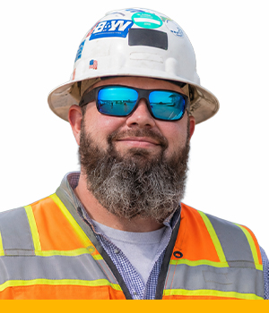
Join Brett Kravitz, ARRAY’s Foundation Engineering Manager; Jon Manning, P.E., a solar foundation design expert at Kimley-Horn; and Drew Powers, EPC Project Manager and Department Manager – Solar Construction at Burns & McDonnell, for a technical deep dive into the critical data inputs behind terrain-following trackers.
Together, they’ll explore how terrain data, foundation design, and construction execution intersect to influence tracker performance, constructability, and project outcomes across complex terrain. This webinar is designed to help Independent Engineers evaluate upstream data with greater confidence—and identify geometric red flags before they become costly construction issues.
Speakers




Why Watch
If you’ve ever reviewed a project where the terrain model “looked fine” but the installed foundations told a different story, this webinar will help you prevent those issues before they happen.
Terrain-following tracker systems place a higher burden on upstream data quality. When survey accuracy, grading surfaces, or geometric inputs are misaligned, the consequences often surface late—during foundation review or construction—when options are limited and risk is highest.
- Reduce uncertainty during foundation and tracker review
- Identify upstream data issues before they become construction problems
- Improve design defensibility and review efficiency
- Understand best practices for mastering terrain-following installation
Built to Support Defensible Foundation Design
ARRAY’s goal is to make your job easier by providing engineering grade tracker inputs that support accurate, reliable, and defensible foundation design—on even the most complex sites.